Maps #6 & #7

As for the other map, I failed to successfully make it in time. I was having a lot of trouble with the Natural Earth Data. At first, the data never showed up when I attempted to add it, but after a suggestion from Dr. Garrity, I was able to see it. Unfortunately, I kept getting this error message after attempting to add the shapefile to ArcGIS.
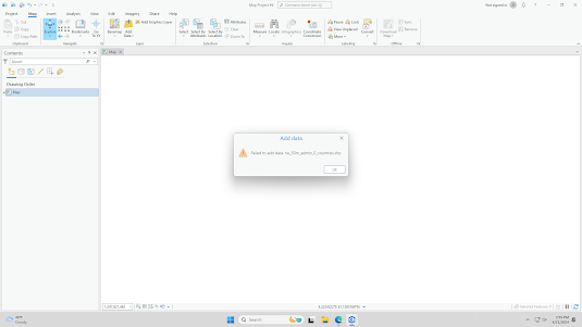
This was very frustrating, and I tried different methods that I found on ArcGIS forums to fix the problem, but I kept getting the same error message. I have a feeling I am the only one having this problem but if I can get it fixed, I would like to actually try making this map.

For Map #7 I made an isarithmic map of the Finger Lakes region using data from the USGS National Elevation Dataset. This map was relatively easy to make but I also struggled a little with it. First, I tried to fix the tilt that the map had but I was unsuccessful. I tried changing the CRS and rotating the map in the layout screen, but both did not work. I also tried to incorporate more map features like a hill shade, but I kept getting odd error messages. Overall, this map took me 45 minutes to make. ArcGIS has a lot of features I still don't understand, and it will take me some time to get used to using this software as opposed to QGIS.
Comments
Post a Comment